
Plan and Zoning Map
How to View Plan and Zoning Information on the Map
To see zoning information on the map:
- Click the Plan Overlay button on the top of the map to activate zoning layers for that region
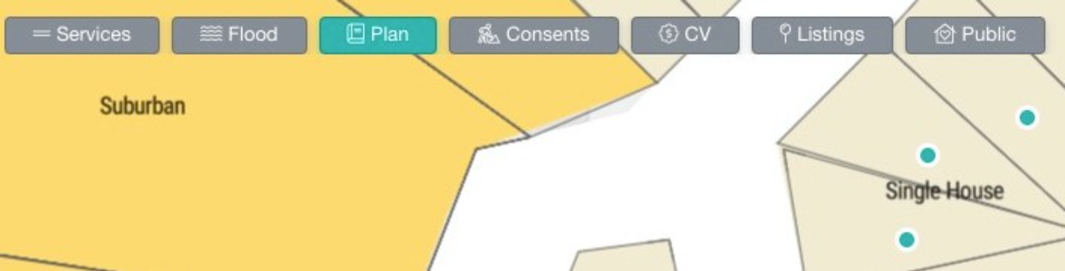
- Zoom in or out to see zone names displayed directly on the map—no legend needed
Understanding Plan Colours and Definitions
Each council in New Zealand uses different names and rules for their zones. For example, what Auckland Council calls "Terrace Housing and Apartment Buildings Zone" might be "High Density Residential" in Christchurch
Because of these regional differences, we display zone names directly on the map rather than using a colour legend. This ensures you always see the exact terminology used by each council. A traditional legend wouldn't work because the same colour could mean completely different zones in different regions.
FAQS
Why is the Plan Overlay button greyed out?
If you see the Plan Overlay option greyed out, this means we have plan data for your region but it cannot be displayed on the Boundary Map view. To access plan overlays, switch to:
- Default map view
- Satellite view
- Contour map view
Which regions have plan overlays available?
Plan overlay data is currently available in key New Zealand regions including Auckland, Waikato & Christchurch. Coverage is continuously expanding as councils make their data available. .
How accurate is the zoning information?
The zoning data is sourced directly from council and is updated regularly. However, always verify current zoning with the relevant council for any formal due diligence, applications or decisions, as zones can change through plan changes and updates.
What do the different plan colours mean?
We display zone names directly on the map as sub text so you can easily see which colour relates to which zone.