
Property Details Explained
How to access the Property Details Panel
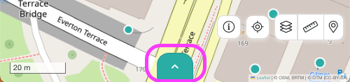
Once you search for a property via the search bar, the Property Details Panel will appear on the right of the map. If it's not there, find the teal arrow to expand it out.
- Use the navigation bar at the top of the panel to jump directly to any section within the Property Details Panel
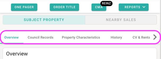
- If you can't see the Property Details Panel, look for the teal arrow icon on the edge of your map to expand it.
- Look at the bottom on your map on mobile, or the right of your map on desktop.
What's in the Property Details Panel?
1. Subject Property Images
Images include the complete history of listing images, including images from previous listings. Images from Google street view or aerial views are also sometimes included. When a property has no listing or sales images available, an aerial boundary map is automatically displayed instead, giving you instant visual context of the property's layout and boundaries.
2. Building/Resource Consents
You can view issued and lodged building and resource consent details for the property. Click the View details button to read further details on the consent.
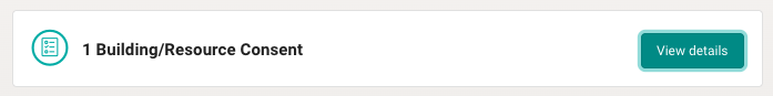
Currently only available in Auckland, Waikato, Christchurch and Wellington (data from 2021 onwards for Waikato, Christchurch and Wellington).
3. Overview
The Overview section provides an "overview" of the property and includes essential property details like the owner, property category, land title, land area, zoning information, legal description, and capacity constraint.
When a property is owned by a company, company information automatically displays in the right-hand panel of the Overview section. This includes director names, shareholder details, and the company's NZBN (New Zealand Business Number). Click View Details to expand the full company information inline.
Auckland properties may include additional Council Zoning information & Watercare Capacity Constraints in the Overview section if they're applicable to the property. These include:
- Overlays, which are special restrictions (e.g., airspace restrictions or environmental overlays),
- Controls, any rules and regulations on the property,
- Designations, which are designated uses or restrictions (e.g., road widening designations)
- Watercare Capacity constraints
4. Council Records
Council Records are the key details about the physical building characteristics, including: floor area, number of bedrooms, bathrooms, parking, cladding and year built.
Please note Council records do not include study or office information. This data is not captured in council databases, so it cannot be displayed in Relab.
5. History
History shows the market, consent and title history of the property, including any changes in: ownership, title documents, listing status, CV and consents.
Please note that consents will only be shown for Auckland, Waikato, Wellington, and Christchurch.
6. Council Valuation
Council Valucation shows the most recent valuation of the property by the council, including land and improvement values. This section also includes details on council rates.
7. Automated Estimate
The Automated Estimate is the property value estimates from QV or REINZ.
REINZ estimates include a market range (low to high) with a confidence score to help gauge potential market value.
8. Suburb Insights
Relab's Suburb Insights gives you comprehensive market data for any suburb you're searching in. View current market conditions, price trends, sales activity, and selling methods
9. Rental Estimates
Rental estimates provides a rental estimate based on the number of bedrooms and room type, through NZ Tenancy Services.
10. School Zoning
School zoning shows the in-zone schools for the subject property. This can be viewed in two tabs: Primary Schools and Intermediate/College. Click on any school for details such as role size, student demographics and school type (public vs private).
11. Demographics
The demographics section provides statistical information about the surrounding area from Statistics NZ.
Key data includes:
- Annual Household Income: A breakdown of household income levels for the area.
- Age Breakdown: A chart showing the distribution of ages in the local area.
- Education: The educational background of the area’s population, including the number of individuals with different levels of education.
- Ethnicity: Information on the ethnic makeup of the community.
- Occupancy: This includes data on whether the property is owner-occupied or a rental.
- Occupations: A breakdown of the types of occupations held by the area's population, useful for understanding the economic makeup of the neighbourhood.