
Services Map
The Services Overlay displays underground infrastructure including stormwater pipes, wastewater systems, and other critical utilities.
How to Use the Services Overlay
Click the Services Overlay button at the top of the map to activate this layer, then zoom in to view detailed information such as pipe materials and diameters.
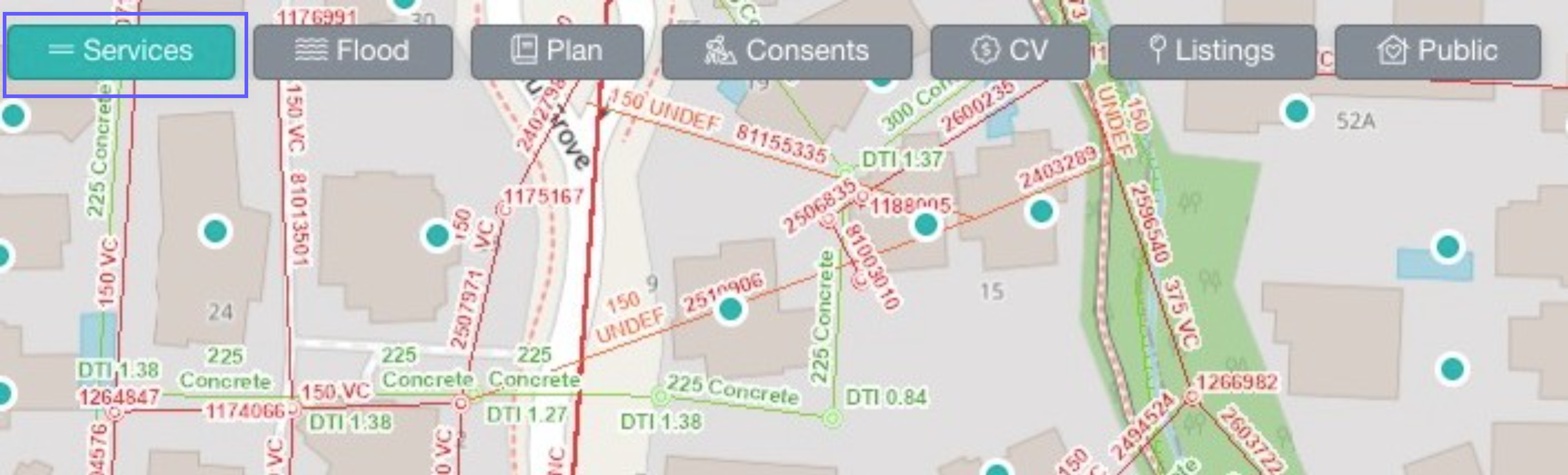
Service Layer Types and Definitions
Standard Services (All Regions)
Wastewater Infrastructure:
- Wastewater pipe (red lines)
 Wastewater manhole (red dots)
Stormwater Infrastructure:
- Stormwater pipe (green lines)
 Stormwater manhole (green dots)
Additional Water Pipes:
When the Services Overlay is active, the following water pipe types are also displayed under the following categories:
- Water Pipe (Local)
- Operational (Non-Potable)
- Operational (Potable)
- Operational Not Vested
- Abandoned / Not Operational
FAQs
Where can I view services on the map?
We currently show services for Auckland, Waikato, Christchurch, Nelson and Queenstown.